Getting around these accessibility issues
Google maps
For issues with station connectivity, you could use Google Maps to determine if they are indeed connected underground. When you zoom in enough you will see the underground stations in pink. In the case of the larger multi-level stations, you may even get to see layouts for specific levels (toggle in green)!
Station layout maps
For JR East stations, those who cannot read Japanese are in luck. You can find the layout maps of specific stations at this official page of JR East. For example, if you search for Suidobashi station and click on the link, you will see the following:
The site also has a legend for you to identify which platform is heading which direction and what each of the symbols mean.
For Yurikamome Line stations which goes to Odaiba and Toyosu, you can find the same information here.
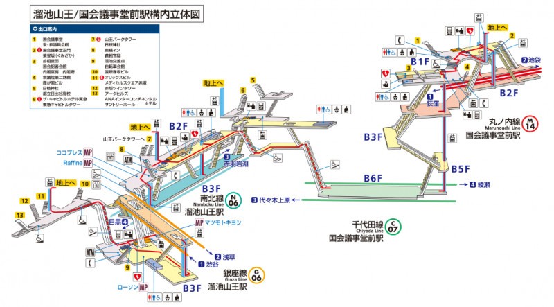
Unfortunately for Tokyo Metro stations, the detailed maps are not available in English although you can find out certain information by search specific station for “barrier-free facilities” here. If you can read Japanese or are somewhat good with deciphering maps, then you can try this.
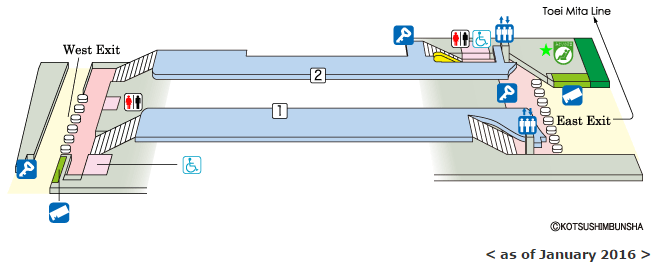
For Toei Subway stations, the same is true. You can get barrier-free facilities information here in English, or you can try your luck with the Japanese site. Once you find the station in question, click on “駅の立体図” to see detailed map on the station layout.
To get a specific station’s layout quickly for Tokyo Metro or Toei Subway, you can google the name of the station + 構内図 or 駅の立体図.
How’s that for information overload? Have fun in Tokyo!
*images in this article are courtesy of JR East, Tokyo Metro and Toei Subway.